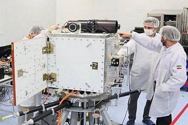
Pars-1 satellite has been designed and constructed by the researchers of the Iranian Space Research Center and is scheduled to be delivered to the Iranian Space Agency.
Meanwhile, the “Nahid-2” telecommunications satellite is also under construction in this research institute.
The ICT ministry has announced that both satellites are going through the final stages of construction and technical testing.
As announced, Pars-1 is supposed to take pictures of all parts of the country using a high-resolution 15-meter-camera and send its photos from a 500-kilometer distance to the earth stations using a high-powered telecommunication transceiver.
These images are to be used to monitor agricultural lands and forests, assess the condition of lakes, and estimate the extent of natural hazards such as fires and floods.
Nahid-2 is reportedly a telecommunication Cubesat Satellite weighing 110 kg, which is the upgraded version of Nahid-1. The satellite can be guided and controlled from the earth and can be floated at an altitude of 550 km for two years by supplying its energy via its solar cells.
Iranian Minister of Communications and Information Technology (ICT) Mohammad Javad Azari Jahromi said in mid-September that "Pars-1" satellite is the most advanced remote-sensing satellite ever built in the country.
According to previous reports, the Iranian Space Agency has plans to launch a number of satellites including Pars-1, Pars-2, Zafar-2, and Nahid-2. They will orbit 500 kilometers above the earth.
HJ/5047437


Your Comment