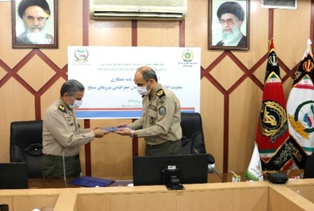
Second Brigadier General Majid Fakhri, the head of the National Geographical Organization of the Armed Forces of Iran stated that the purpose of the signing of this MoU is to develop cooperation in the fields of intelligence, human capital, scientific, educational and research interactions as well as exchanging the two organization’s expertise and experiences in this regard.
He also stressed that both sides use capabilities of each other to meet the country’s need for modern geographic and geomatics technologies in the field of security and added that the cooperation for providing spatial information systems and user services is one of the issues agreed upon in this document.
He went on express the readiness of the National Geography Organization to cooperate with all organizations of the Armed Forces such as collecting descriptive data to enrich the defense spatial database and set up Defense Spatial Data Infrastructure at the lowest cost in the shortest time.
Second Brigadier General Jalali Nasab, the head of intelligence branch of Army’s Ground Force also called the signing of this document fruitful and said that the MoU will meet the Army's need for spatial data, including border photography, satellite imagery, and the linking of descriptive information and spatial data.
RHM/4988707












Your Comment