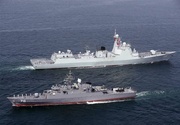
ECDIS has been designed and built by the researchers of Iran's Armed Forces Geographical Organization.
Head of the geographical organization of the Armed Forces Brigadier General Majid Fakhri said that ECDIS is an advanced electronic navigation system that can be installed on military and commercial vessels.
"The system displays electronic maps on its screen, with information hidden in its different layers," he added.
According to Brigadier General Fakhri, the homegrown ECDIS facilitates the process of navigation by providing information, tools, and various facilities needed for navigation.
The Iranian navy commander Rear Admiral Shahram Irani also attended the unveiling ceremony.
The event was held on Monday on the occasion of June 21, World Hydrography Day.
SKH/5832625


Your Comment