Iran is the ninth country in the world after the Soviet Union, the United States, France, Japan, China, the United Kingdom, India and the Zionist regime that has successfully launched a satellite independently.
Since 2005, Iran has joined the club of space countries by sending the Sina-1 satellite, which was sent into orbit with the help of Russia. Since then, the Iranian Space Agency has put planning for the use of space and the expansion of space technologies in the country using local knowledge and international cooperation on the agenda.
Then, Iran was able to move towards launching satellites in addition to designing and building them by creating scientific infrastructures which were achieved by developing space launch terminals.
In addition to the development of space launch terminals, the development of satellite carriers has also been effective in achieving the country's cycle of designing and producing indigenous satellites.
The ‘Safir’ satellite carrier was designed and built in 2008 and the ‘Simorgh’ satellite carrier was in 2017. ‘Sarir’ and ‘Soroush’ satellite carriers also added to the space technology of the country.
Iran managed to launch several satellites with this equipment, some of which were successful and some of which were unsuccessful.
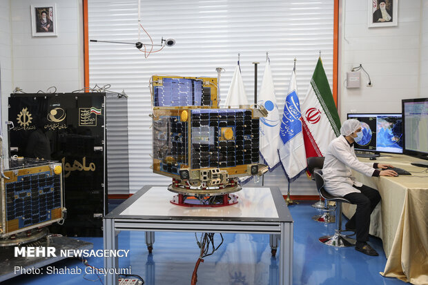
‘Sina-1’ is the first Iranian artificial satellite, launched at 6:52 UTC on October 28, 2005, on board a Cosmos-3M Russian launch vehicle from the Plesetsk Cosmodrome. Remote sensing, receiving, storing and sending telecommunication data were the two missions of this satellite.
Iran launched its first homemade satellite, ‘Omid’ (Hope), in 2009. After being launched by an Iranian-made carrier rocket, Safir 1, the satellite was placed into a low Earth orbit. Omid was a data-processing satellite for research and telecommunications. The launch, which coincided with the 30th anniversary of the Islamic Revolution was also verified by NASA the following day as a success. The launch of Omid made Iran the ninth country to develop an indigenous satellite launch capability.
‘Rasad’ (Observation) was another Iranian satellite which was launched in 2011. The third Iranian satellite, and the second to be launched successfully using an indigenous rocket, Rasad was Iran's first imaging satellite. Launched aboard a Safir-B carrier rocket, it was successfully placed into a low Earth orbit at an altitude of 236 by 299 kilometres (147 by 186 mi), inclined at 55.7 degrees. It made approximately fifteen orbits per day. The launch occurred at approximately 09:14 UTC on 15 June 2011 with the spacecraft reaching orbit several minutes later.
The satellite had a mass of 15.3 kilograms (34 lb) and returned images with a resolution of 150 metres (490 ft). It was equipped with solar panels to generate power. The satellite decayed from orbit three weeks after launch, on 6 July 2011.
‘Navid’ (Promise) was an experimental Iranian Earth observation satellite. As the third satellite launched indigenously by Iran, it carried a camera for taking higher-resolution imagery of Earth and it was also used to collect weather data and monitor natural disasters. The launch occurred at approximately 00:04 UTC on 3 February 2012. The satellite remained in orbit for two months, before reentering the atmosphere on 1 April 2012.
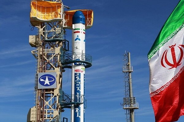
‘Fajr’ (Dawn) satellite was launched on 2 February 2015. It had a mass of 52 kg and was equipped with an optical imaging payload which would have reached a ground resolution of about 500 metres (1,600 ft). It was the first Iranian satellite to use a cold-gas thruster system to conduct orbital maneuvers and increase its service life by raising its orbit to prevent a fast decay. Fajr was launched by a Safir-1B rocket from the Iranian Space Agency's launch site in Semnan city. The satellite was deployed into a low Earth orbit with a perigee of 224 km, an apogee of 470 km, an inclination of 55.53°, and an orbital period of 91.5 minutes.
‘Payam’ (Message) satellite was launched on 15 January 2019 with Simorgh satellite carrier but according to the announcement of then-Minister of Communications and Information Technology Mohammad Javad Azari Jahromi the launch was not successful and the Payam satellite was not put into orbit. The rocket carrying the Payam satellite failed to reach the “necessary speed” in the third stage of its launch. It was designed and developed by experts at the Amirkabir University of Technology to carry out imagery and telecommunication missions. It was aimed to orbit the Earth at an altitude of 500 kilometers to take surveying images at high resolutions.
‘Dousti’ (Friendship) satellite was the second Iranian satellite which faced an unsuccessful launch in 2017. It was a micro-class 52-kilogram satellite developed by experts from the Sharif University of Technology. It was a remote-sensing satellite, which was to orbit the Earth at an altitude of between 250 km and 310 km. The satellite was launched on a Safir-1B rocket in February 2019 but did not reach orbit.
‘Zafar-1’, was an imaging satellite launched in 2012 which didn't achieve the required speed to reach its orbit. It plummeted into the Indian Ocean after it failed to reach orbit.
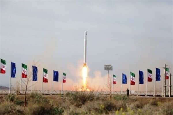
The elite force of Iran’s Islamic Revolutionary Guards Corps (IRGC) successfully launched the ‘Noor-1’ (Light) satellite by the domestically-built launcher Qassed (Messenger) on 22 April 2020 and placed it into orbit at an altitude of 425km. The launch of Noor-1 which is the Islamic Republic’s first military satellite was carried out on the anniversary of the establishment of the IRGC.
‘Noor-2’, the second and only operational satellite of the Noor class, was launched on 8 March 2022 to a 500-kilometer orbit. The mission of the satellite is reconnaissance, and it was placed in orbit after 480 seconds at a speed of 6.7 km/s. Two Noor satellites have been launched from the Shahrud Desert in Iran.
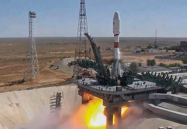
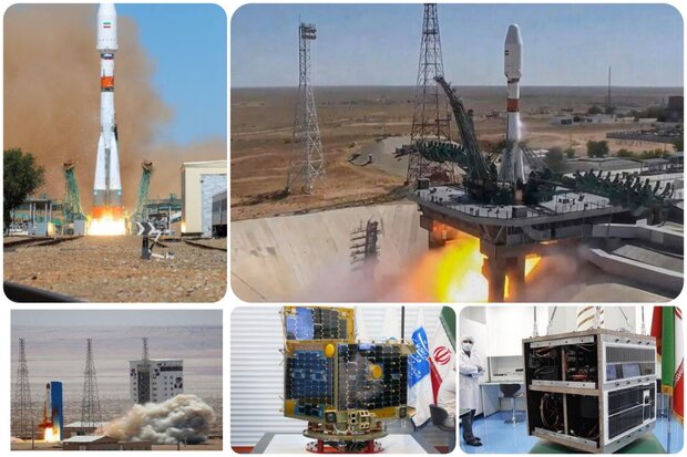
The Iranian satellite ‘Khayyam’ was launched on a Soyuz-2.1b carrier rocket from the Baikonur Cosmodrome in Kazakhstan on 9 August 2022. It is named after the Iranian polymath Omar Khayyam. Khayyam is a 600 kilograms (1,300 lb) satellite situated in an orbit 500 kilometres (310 mi) above the Earth's surface. Its main purpose is to collect information and images from the Earth's surface with a resolution of 1 metre (3.3 feet). It is designed to monitor and investigate the Earth's surface, both for government and civilian purposes.
By: Zahra Mirzafarjouyan







Your Comment