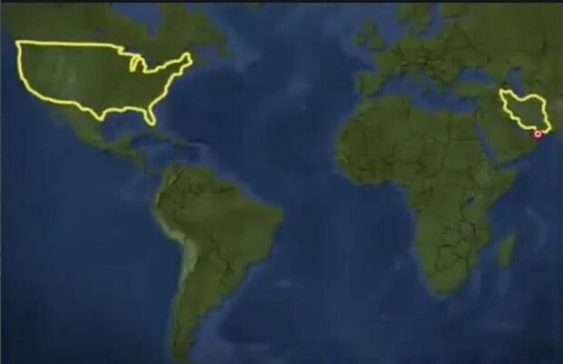
Zarif re-tweeted a map originally posted on June 22 that shows the borders of Iran and the United States, captioning it with a single word: “Reminder”.
His tweet came a few hours after US President Trump claimed that a US ship had shot down an Iranian drone in the Strait of Hormuz.
Trump said that the USS Boxer fired on the drone Thursday, four weeks after Iran shot down a US surveillance drone flying over Iranian waters near the Strait of Hormuz.
“The Boxer took defensive action against an Iranian drone, which had closed into a near distance, approximately 1000 yards, ignoring multiple calls to stand down threatening safety of ship and ship’s crew,” Trump said.
He added that Iran’s drone “was immediately destroyed,” and the Pentagon claimed the Iranian drone was within a “threatening range” of the US ship.
Meanwhile, Zarif said he was not aware of any downing of an Iranian drone.
"We have no information about losing a drone today," Zarif told reporters at the United Nations before a meeting with Secretary-General Antonio Guterres.
The incident also happened a few hours after Iran's Islamic Revolution Guards Corps (IRGC) said it had seized a foreign tanker that was smuggling fuel in the Persian Gulf near the Strait of Hormuz.
The tensions between Washington and Tehran have been escalating under Trump. Leading a policy of “maximum pressure,” the US quit a United Nations-ratified nuclear agreement between Iran and six world states. It then proceeded to restore the sanctions that had been lifted under the deal.
It has, in addition, sent an aircraft carrier strike group, a bomber task force, an amphibious assault ship, and some 1,500 more forces to the region.
MNA
